Resolving Kinematic Characteristics of Anthropogenic Seismic Sources using Dense Nodal Arrays and Spatiotemporal Deep Learning
Yu, M., Chai, M., Meng, H., et al. — Journal of Applied Geophysics, 2026
Under Review
Abstract
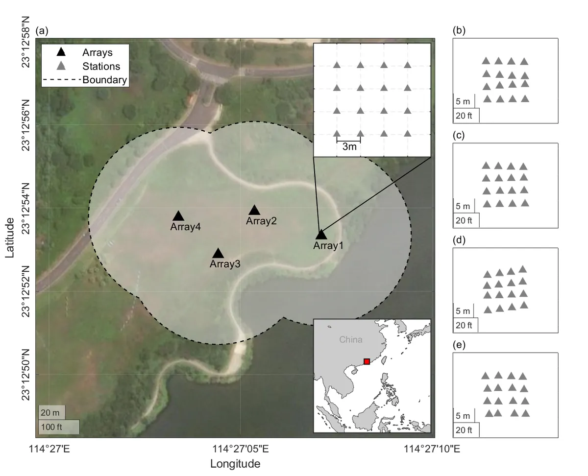
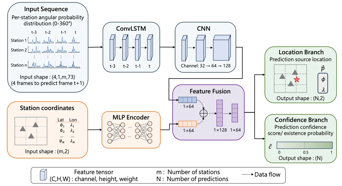
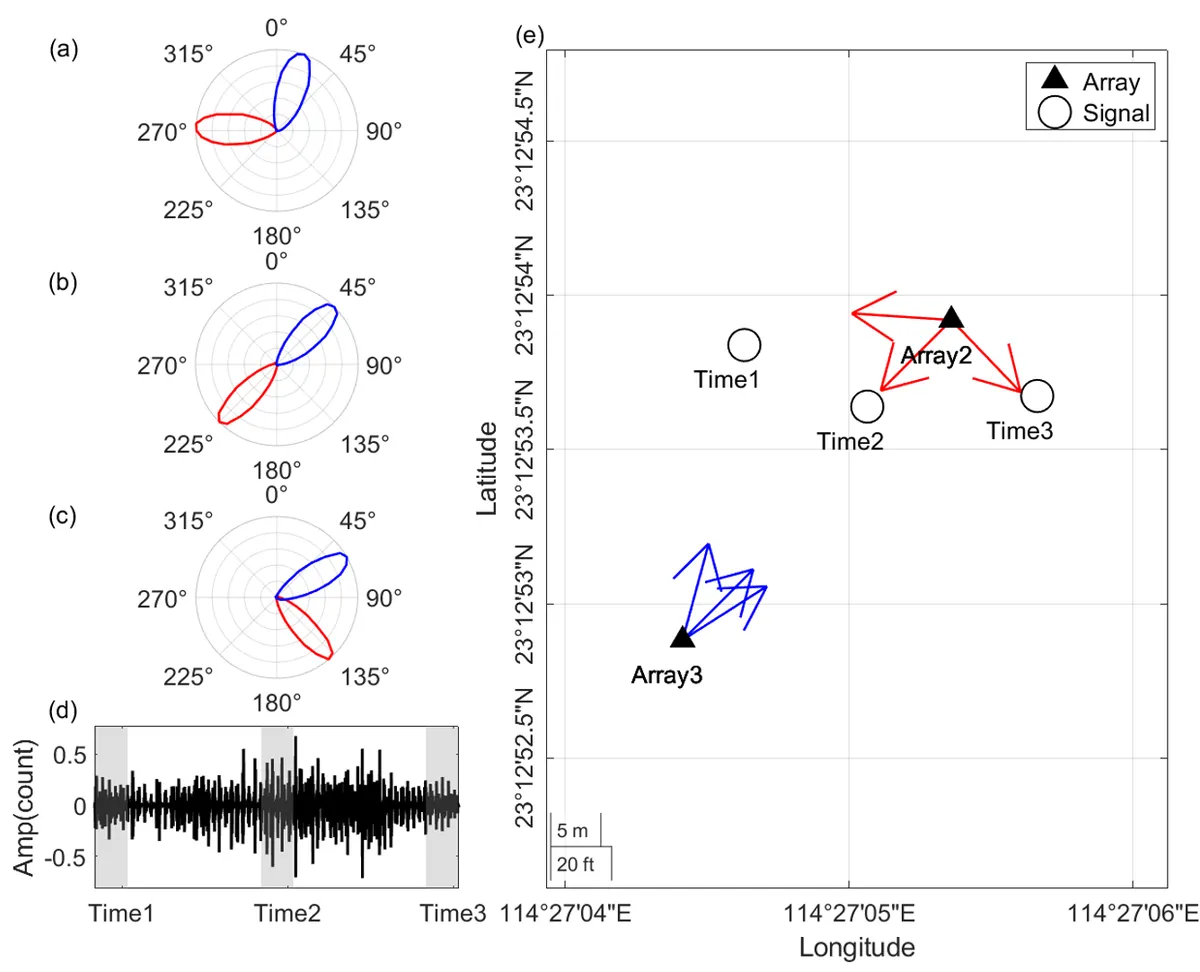
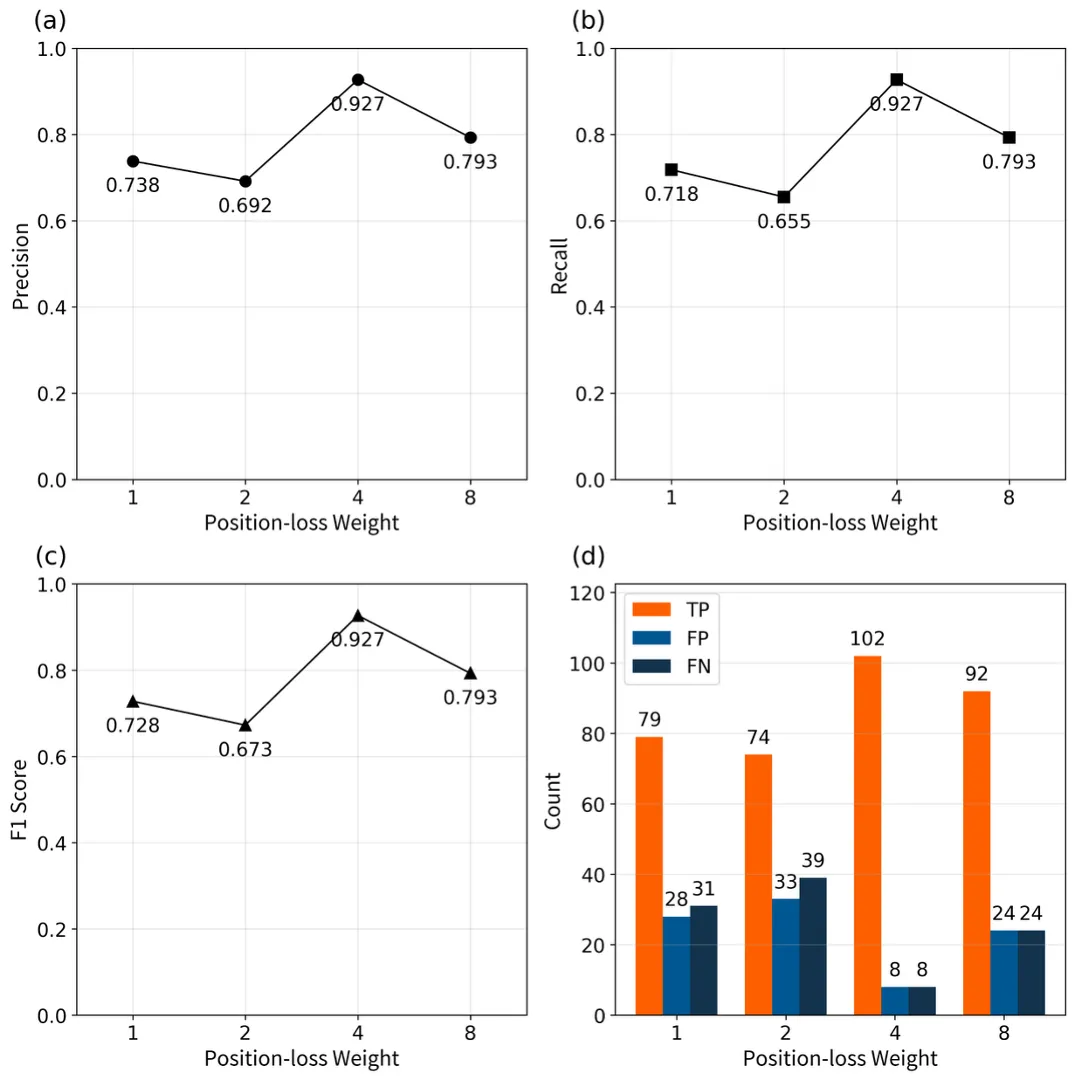
Continuous monitoring of shallow anthropogenic seismic sources — pedestrians, vehicles, construction, and industrial machinery — is challenging in urban environments due to complex wavefield scattering and high ambient noise. We present a systematic framework for tracking single and multiple moving sources using small-aperture dense nodal arrays. For isolated sources, multi-array delay-and-sum beamforming combined with geometric cross-localization and an empirical, field-calibrated slowness correction achieves an 87.48% localization accuracy with a 4.03 m spatial uncertainty (RMSE) on field data from four 4x4 nodal arrays (3 m spacing) in Huizhou, China. For concurrent multiple sources, geometric cross-localization produces a highly aliased objective function with a combinatorial explosion of spurious intersections. We address this by reformulating multi-target tracking as an end-to-end spatiotemporal sequence-prediction problem, introducing a dual-input Convolutional LSTM (ConvLSTM) architecture that fuses dynamic multi-array beam-energy sequences with static array-position encoding. Optimized via Hungarian matching and a joint position-confidence loss, the network resolves severe multi-source ambiguities — including crossing and closely parallel trajectories — achieving an F1-score of 0.927 and a mean localization error of 2.76 m on independent field data.
Status: Submitted to Journal of Applied Geophysics in July 2026; currently under review.
Contribution: Co-first author. Developed the multi-array beamforming and cross-localization pipeline, derived the field-calibrated slowness correction map, and co-designed the dual-input ConvLSTM tracking architecture and its Hungarian-matching training objective.
Code & Data: GitHub repository · Zenodo archive: code · field data
Significance: This work bridges classical array seismology with geometry-aware deep learning for urban intelligence applications — resolving ambiguities that defeat purely geometric source tracking and directly demonstrating the translational impact of geophysical methods on city-scale monitoring solutions.
Figures