Miao YU
← Publications

Research on 3D Modeling Method of Complex Ore Body (复杂矿体的三维建模方法研究)

Yu, M., et al. — Science and Technology Innovation Herald, 2013

Published

3D Geological ModelingOre Body CharacterizationSpatial InterpolationMineral Exploration

Abstract

To intuitively display the geometry and distribution of an underground complex ore body, this paper implements 3D modeling by combining a lateral/vertical extension modeling method for the geological body with three-dimensional spatial interpolation, based on two-dimensional geophysical exploration profiles (magnetic and electrical prospecting) and drillhole data. A spatial median filter is used to suppress the anomalous points introduced by the interpolation. Applied to a magnetite ore body, the method reconstructs a 3D model of the ore vein, ground surface, and lithological boundaries that is consistent with the underlying 2D profiles and drillhole constraints.

Venue: Science and Technology Innovation Herald (科技创新导报), 2013, No. 22, pp. 75-76. DOI: 10.16660/j.cnki.1674-098x.2013.22.009

Note: Supported, during undergraduate studies, by the National College Students’ Innovation and Entrepreneurship Training Program (201210616004) and the National Natural Science Foundation of China (41274130) — demonstrating early research engagement and publication capability.

Figures
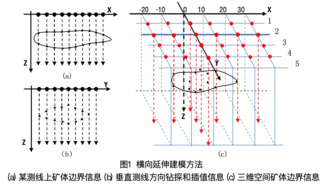
Lateral-extension modeling method: (a) ore-body boundary picked on a single survey line, (b) drillhole and interpolation data along the line's normal direction, (c) resulting 3D boundary coordinates.
Figure 1. Lateral-extension modeling method: (a) ore-body boundary picked on a single survey line, (b) drillhole and interpolation data along the line's normal direction, (c) resulting 3D boundary coordinates.
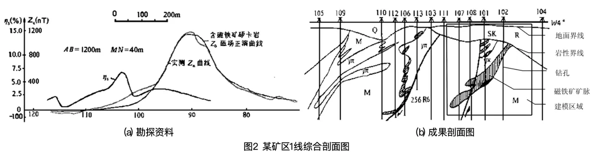
Line-1 composite profile: (a) measured magnetic (Za) and induced-polarization (ηs) survey curves used to locate the magnetite skarn body, and (b) the resulting geological section used as the 3D modeling input.
Figure 2. Line-1 composite profile: (a) measured magnetic (Za) and induced-polarization (ηs) survey curves used to locate the magnetite skarn body, and (b) the resulting geological section used as the 3D modeling input.
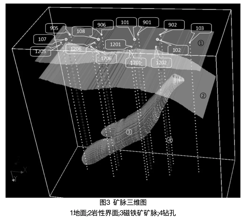
Resulting 3D ore-vein model, showing the ground surface, lithological boundary, magnetite ore vein, and drillhole positions used to constrain it.
Figure 3. Resulting 3D ore-vein model, showing the ground surface, lithological boundary, magnetite ore vein, and drillhole positions used to constrain it.
Export BibTeX ⇩